
Browse Items
Explore our collection of items

Accuracy of determining vertical deformations by the method of differential interferometry
With the development of satellite SAR interferometry, it became possible to remotely obtain infor...

Analysis of vertical movements of the permanent GNSS‒station POLV on the base of satellite data and leveling
The purpose of this work is to analyze the results of the study of the dynamics of vertical movem...
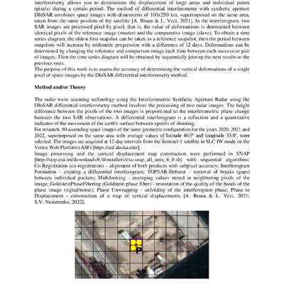
Accuracy of determining vertical deformations by the method of differential interferometry
With the development of satellite SAR interferometry, it became possible to remotely obtain information about deformations of the Earth's surface. Differential Interferometry Synthetic Aperture Rad...
2025/12/17
Analysis of vertical movements of the permanent GNSS‒station POLV on the base of satellite data and leveling
The purpose of this work is to analyze the results of the study of the dynamics of vertical movements of the permanent station of the GNSS positioning system «Poltava» (identifier POLV). Method. A ...
2025/12/17