Кафедра автомобільних доріг, геодезії та землеустрою
Explore our collection of items
Динаміка вертикальних рухів земної поверхні Придніпровської низовини
Здійснено аналіз динаміки вертикальних рухів перманентних супутникових станцій земної поверхні Пр...

Geoinformation management systems at an agricultural enterprise of organic production
In Ukraine, agricultural enterprises that have introduced organic production organize their activ...
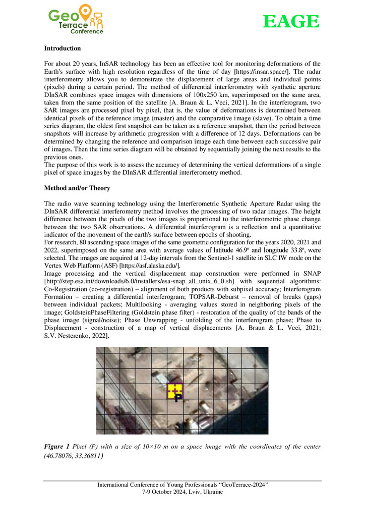
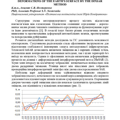
Accuracy of determining vertical deformations by the method of differential interferometry
With the development of satellite SAR interferometry, it became possible to remotely obtain infor...
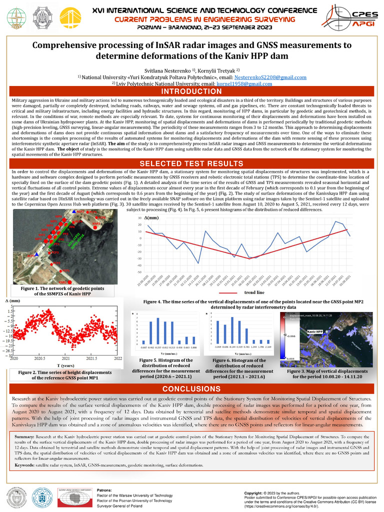
Comprehensive processing of InSAR radar images and GNSS measurements to determine deformations of the Kaniv HPP dam
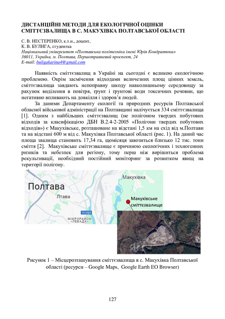
Military aggression in Ukraine and military actions led to numerous technogenically loaded and ec...
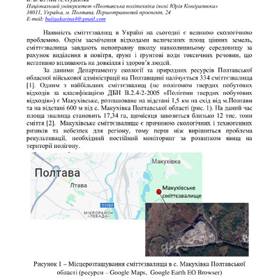
Satellite Monitoring of Technogenically Hazardous Areas in Poltava Region
Over the past half-century, Poltava region has undergone significant territorial changes that hav...
Analysis of vertical movements of the permanent GNSS‒station POLV on the base of satellite data and leveling
The purpose of this work is to analyze the results of the study of the dynamics of vertical movem...

Вибір безпілотних рішень для потреб українського споживача
Розглянуто галузі використання безпілотних літальних апаратів (БПЛА), перелічено основні завдання...


Transport Eurointegration of Ukraine (Ways to Revitalize Dnipro Reservoirs)
Based on the monitoring of changes in the state of reservoirs over the past 50 years, the ways of...

Підвищення ефективності використання земельних ресурсів в Україні
Мета. Дослідження ефективності та раціонального використання земельних ресурсів та розробка факто...

Методи дистанційних досліджень для визначення руйнувань урболандшафтів
Використання сучасних методів дослідження територій є особливо важливим елементом відслідковуванн...
Геоматичний моніторинг екологічних загроз на техногенно-навантажених територіях
Відмічено, що територія Східної України насичена потенційно небезпечними промисловими об’єктами т...

Динаміка вертикальних рухів земної поверхні Придніпровської низовини
Здійснено аналіз динаміки вертикальних рухів перманентних супутникових станцій земної поверхні Придніпровської низовини на основі даних ГНСС–вимірів і дистанційного зондування Землі. Визначено зміщ...
Стаття 2025/12/17
Органічне землеробство як засіб охорони ґрунтів
Стаття 2025/12/17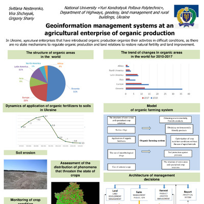
Geoinformation management systems at an agricultural enterprise of organic production
In Ukraine, agricultural enterprises that have introduced organic production organize their activities in difficult conditions, as there are no state mechanisms to regulate organic production and l...
2025/12/17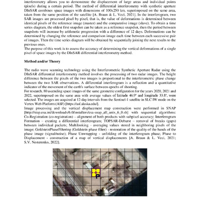
Accuracy of determining vertical deformations by the method of differential interferometry
With the development of satellite SAR interferometry, it became possible to remotely obtain information about deformations of the Earth's surface. Differential Interferometry Synthetic Aperture Rad...
Стаття 2025/12/17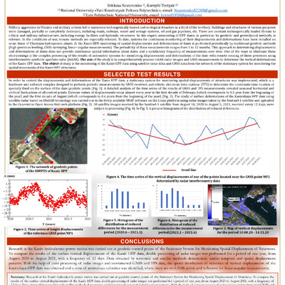
Comprehensive processing of InSAR radar images and GNSS measurements to determine deformations of the Kaniv HPP dam
Military aggression in Ukraine and military actions led to numerous technogenically loaded and ecological disasters in a third of the territory. Buildings and structures of various purposes were da...
Стаття 2025/12/17
Satellite Monitoring of Technogenically Hazardous Areas in Poltava Region
Over the past half-century, Poltava region has undergone significant territorial changes that have affected land use and the state of the environment. The number of areas with a high level of techn...
Стаття 2025/12/17

Analysis of vertical movements of the permanent GNSS‒station POLV on the base of satellite data and leveling
The purpose of this work is to analyze the results of the study of the dynamics of vertical movements of the permanent station of the GNSS positioning system «Poltava» (identifier POLV). Method. A ...
Стаття 2025/12/17
Вибір безпілотних рішень для потреб українського споживача
Розглянуто галузі використання безпілотних літальних апаратів (БПЛА), перелічено основні завдання, які можна вирішувати за допомогою дронів. Серед світових виробників виявлено лідерів на ринку літа...
2025/12/17
Transport Eurointegration of Ukraine (Ways to Revitalize Dnipro Reservoirs)
Based on the monitoring of changes in the state of reservoirs over the past 50 years, the ways of their revitalization were analyzed and proposed in order to form a full-fledged waterway and return...
Стаття 2025/12/17
Підвищення ефективності використання земельних ресурсів в Україні
Мета. Дослідження ефективності та раціонального використання земельних ресурсів та розробка факторів підвищення ефективності їх використання в Україні.
2025/12/17
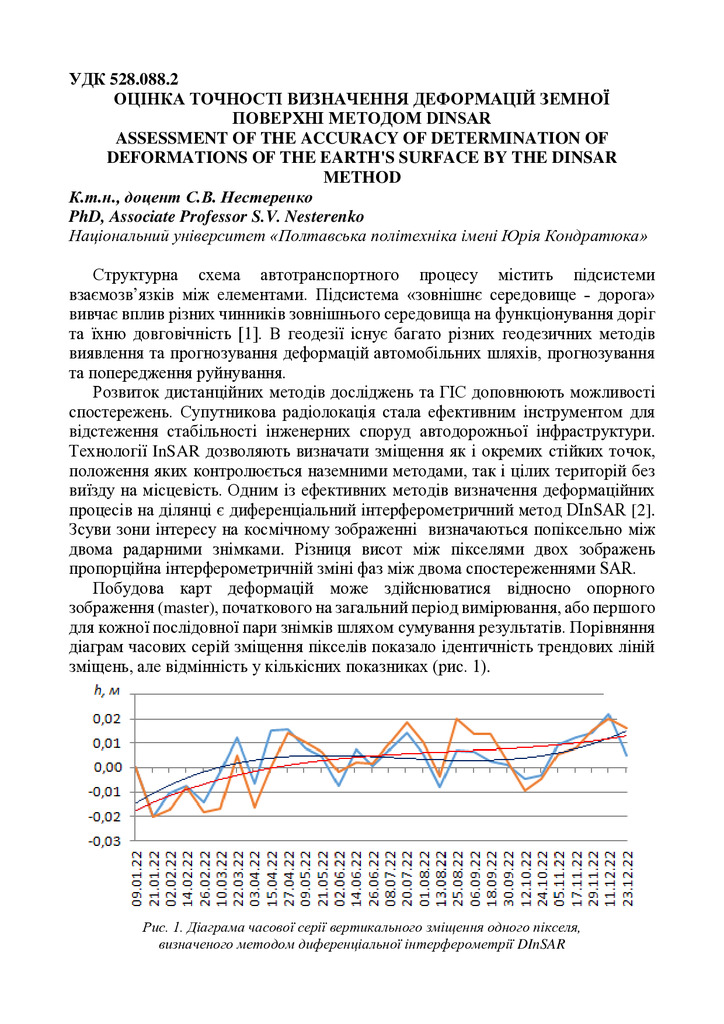
Оцінка точності визначення деформацій земної поверхні методом DInSAR
Стаття 2025/12/16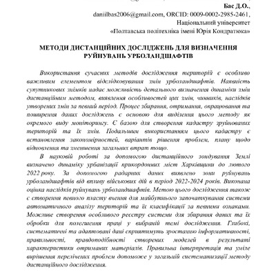
Методи дистанційних досліджень для визначення руйнувань урболандшафтів
Використання сучасних методів дослідження територій є особливо важливим елементом відслідковування змін урболандшафтів. Наявність супутникових знімків надає можливість детального визначення динамік...
Стаття 2025/12/16
Геоматичний моніторинг екологічних загроз на техногенно-навантажених територіях
Відмічено, що територія Східної України насичена потенційно небезпечними промисловими об’єктами та ділянками з геодинамічними процесами, за якими необхідний постійний контроль і моніторинг для вияв...
Стаття 2025/12/16